Anna Maria Island is a wondrous vacation getaway, and one of the top gulf coast destinations in Florida.
But the big questions may still remain: where is it? How do you get here?
We cover the best routes to the island, what airport to use, and how you can find this majestic beachside nook for your upcoming vacation escape.

Where is Anna Maria Island on the Map?
First, we start by zooming out wide. Anna Maria Island is located right along the Gulf of Mexico in Florida. Look about halfway down Florida’s boot, just below Tampa, and you are sure to settle somewhere along Anna Maria Island’s seven-mile stretch. It is snug tight between Sarasota and Tampa.
What Airport Do You Fly Into?
There are three main airports near the island. Which airport you use depends on your travel itinerary and the city you choose to fly into. The three closest major airports are Tampa International Airport (TPA), Sarasota-Bradenton International Airport (SRQ), and Orlando International Airport (MCO).
The closest is SRQ, though flights are expectedly limited. The furthest airport is in Orlando, but it is one of the largest airports in the state and a perfectly reasonable flight-in if you end up spending any time at Disney World.

What’s the Most Direct Route to the Island from the Cities?
Which major road you take to the island will depend on which city you start at. If you wind up in Orlando, you are certainly going to take I4 west to the island. This is the major route across the state of Florida, and one you will likely utilize if you head to the eastern side as well. There is no toll road on I4. The drive from Orlando to Anna Maria Island takes about two hours.
If you are coming in from Tampa, 75 South will be your main road to the island. It carries southwest, but you will want to jump off near Bradenton to get to Anna Maria Island. This drive will take at least an hour.
Lastly, visitors from Sarasota will have a nice non-highway ride to their destination. The most direct route is along 301 as it carries directly east of the island. You will eventually want to hit a left at 64 or 684 in Bradenton proper or South Bradenton to reach the island. This drive will take, on a good day, about 40 minutes.
How do You Get to the Island?
After zooming in a bit, you will eventually see the local streets in and around Anna Maria Island. There are three total main roads onto the island. The first is at the northern point. This is by 64, locally called Manatee Ave. This will take you close to Anna Maria city.
The second main entrance is near the middle of the island by Cortez Beach. This is called Cortez Rd and it will land you right at the heart of Bradenton Beach.
How About the Scenic Route?
Finally, we also recommend the southernmost bridge access point by way of Longboat Key. It is likely the longest ride in, and only viable for visitors coming from the south, but it is a stunning run along the breadth of Anna Maria Island’s coastline. This route is useful for anyone coming in from Sarasota. It is a wonderful drive as you can see the water in many spots from the road. To utilize this path, you have to escape west in the Sarasota area and drive through St. Armand’s Circle and then up to Longboat Key.

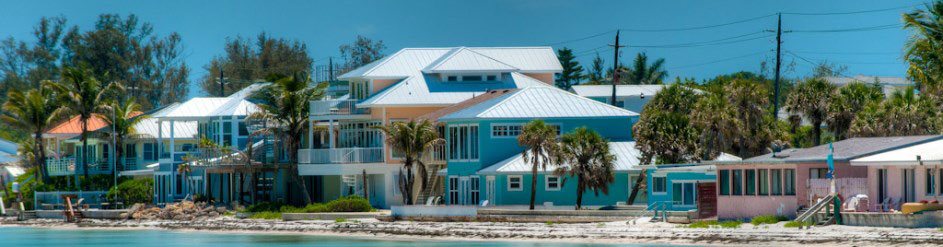
Where is the Best Anna Maria Island Lodging?
The best lodging is by the beach, of course! We want you to have an absolutely thrilling time when you finally make your way to the island. Contact us about all our Anna Maria Island houses for rent. We can connect you with the perfect home for you and your whole crew. We have beach views, furnished kitchens, pool access, and more.
Stay right by the water. Relax by the pool. Admire the view from the balcony. We have fallen in love with Anna Maria Island, and we are sure you will too.